
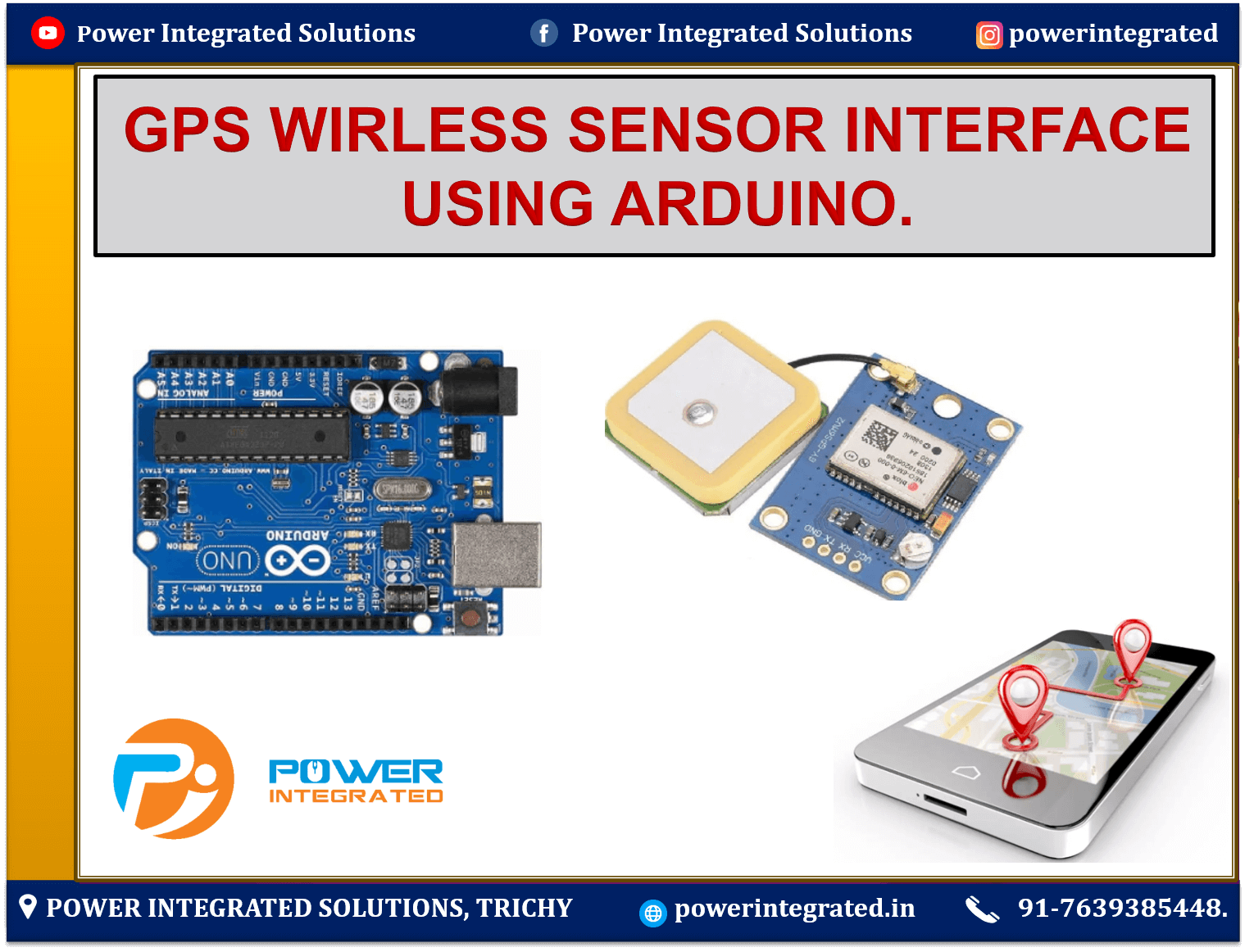
GPS WIRELESS SENSOR INTERFACE USING ARDUINO
📡 GPS Interface with Arduino – Short Note
Overview:
A GPS (Global Positioning System) module allows Arduino to receive real-time location data such as latitude, longitude, altitude, speed, and time. These modules typically communicate over serial using the NMEA protocol, and commonly used GPS modules include NEO-6M or u-blox.
🔧 Working Principle:
The GPS module communicates with satellites orbiting Earth.
It receives signals from at least 4 satellites to calculate an accurate location.
The data is sent to Arduino in the form of NMEA sentences (e.g.,
$GPGGA,$GPRMC).Using a serial interface (hardware or
SoftwareSerial), Arduino reads and decodes the GPS data.
🔌Connection:
GPS MODULE
- POWER Adapter.
Arduino Board
Jumper Wires.
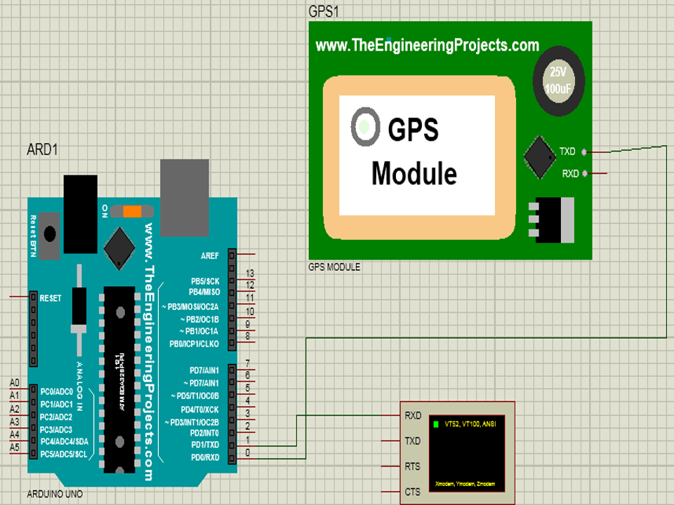
| GPS Module Pin | Arduino UNO Pin |
|---|---|
| VCC | 5V |
| GND | GND |
| TX | Digital Pin 0 |
| RX | Digital Pin 1 |
💻 Libraries Used:
SoftwareSerial.hTinyGPS++(for parsing NMEA sentences easily)
🔌 Circuit Diagram:
📝 Sample Arduino Code:
✅ Key Fixes in the Code
SoftwareSerial Added:
SoftwareSerial gpsSerial(0, 1);was added to interface with the GPS module (TX/RX pins).Your original code used
Serialfor both GPS and Serial Monitor, which would cause conflicts.
Proper Serial Initialization:
gpsSerial.begin(9600);was added insetup()to initialize GPS communication.
Loop Logic Organized:
Reading GPS data for 1 second is preserved using
millis()but moved into a cleaner structure.
Corrected Position Extraction:
gps.f_get_position()is used properly with null checks for invalid data.
Improved Serial Output:
More readable output with clear labels like
"Latitude:"and"Longitude:".
Removed Redundant/Incorrect Lines:
Serial.println(failed);was not connected to any calculation and was removed.Nested braces
{}and misplacedSerial.println("Hi")removed for clarity.
💡 Additional Suggestions
Use
TinyGPS++instead ofTinyGPSfor more features like speed, date, course, etc.Add a check for
ageto validate how old the GPS data is.Consider integrating with GSM, LCD, or cloud platforms like ThingSpeak for real-world applications.
✅ Applications:
Vehicle tracking
Navigation systems
Wildlife or asset monitoring
Weather balloon telemetry
Disaster rescue systems
📞 For More Details & Project Support:
Power Integrated Solutions
Networks | Electronics | Home Automation | Water Automation | IoT | PLC | Embedded | DBMS
📍 Location:
10A/3, Radhakrishnan Colony,
Sasthri Road, Tennur,
Tiruchirappalli, Tamil Nadu – 620017
📧 Email:
📱 Phone / WhatsApp:
+91 76393 85448
+91 82488 85959
🌐 Let’s Build the Future with Innovation in Education & Technology!